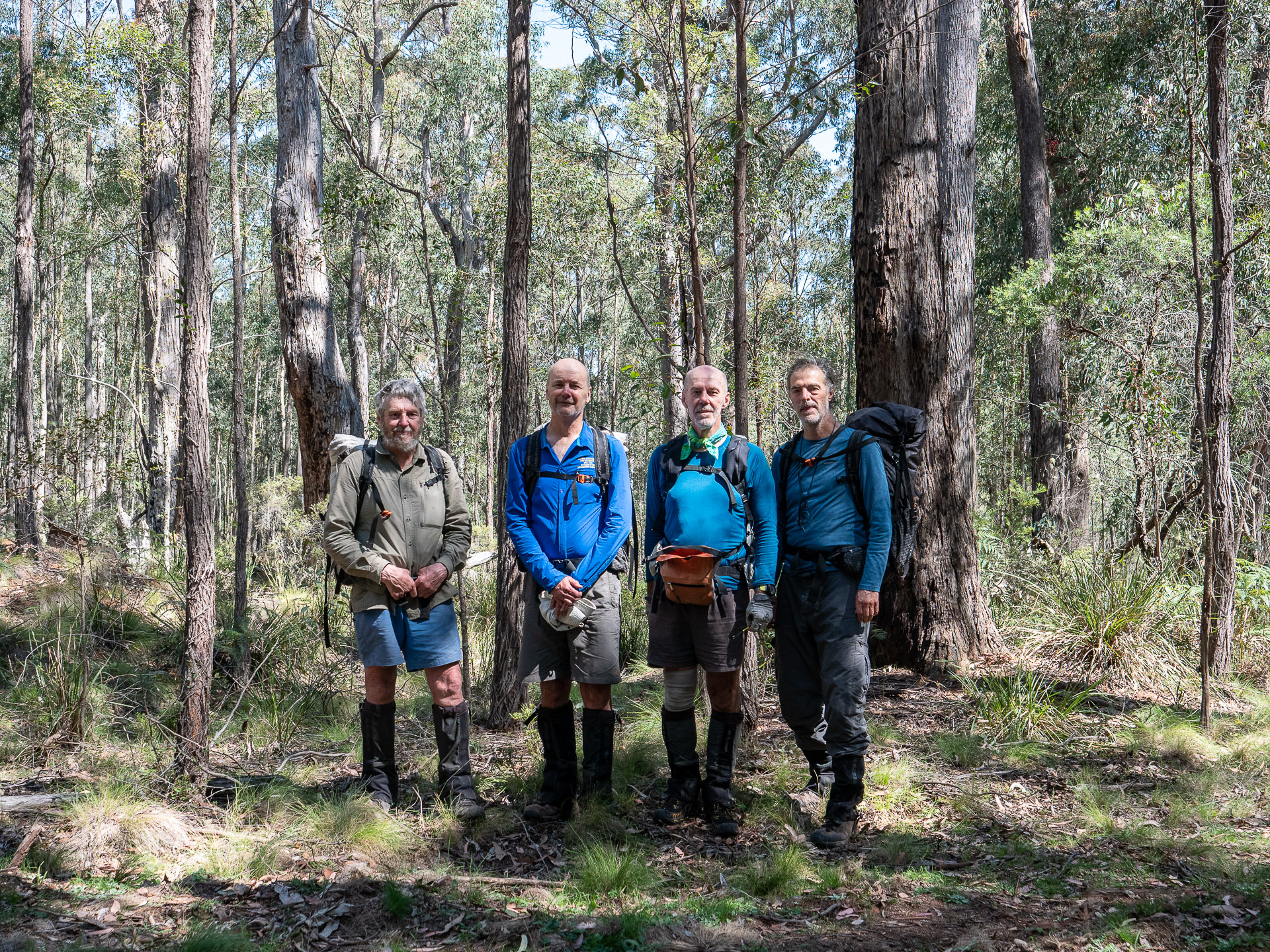
Day 1, September 24, 2020 – the car shuffle (1km walk to camp)
It’s a bit more than three and half hours drive from Katoomba to Gloucester, including over an hours driving once you leave the M1 freeway on 120km of the narrow, uneven Bucketts Way. After a café lunch, the car shuffle took the rest of the day, up and over the Eastern Escarpment on Thunderbolts Way turning left into the Nowendoc State Forest.
Turnoff Bucketts Way left at the Wild Cattle Creek Road (365744E 6524097N) and then follow it and the Myall Management Road south to its end a few kilometres past the pine forest. The alternative of Millers Road that we took is probably now impassible as it was an eroding culvert and creek crossing only just negotiable in 2020.
Having now deposited a car at the exit point our party of four drove 100km back down the mountain. Turn right off Thunderbolts Way at Curracabark Road about 4 kilometres after the Manning River bridge and drive further 15 kilometres to the Woko Campground, which is on the Flood Detour Road. We left the other car at the campground and walked to a camp site on the Cliff Face Walk with enough water for the night and the following day in the ever-deepening twilight, hoping to hear koala’s bellowing, but it seemed that the 2019 wildfire had got them.
Day 2, September 25 – Woko Camp to Mira Creek – (750m climb and 6km off track)
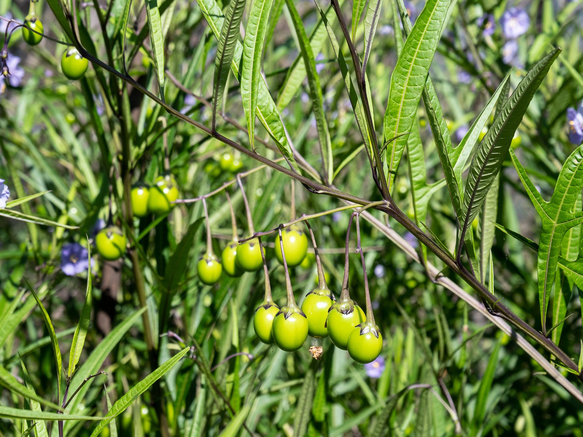
The steep 450 metre climb to the top of the Woko ridge and the traverse of the rocky ridge tops to the Giro Fire Road took up most of the day. The 2019-2020 fire mapping indicated Woko National Park was unburnt, but unfortunately this ridge had suffered an intense crown fire. Weedy native solanum vegetation had sprung up forming a tangle of weeds and vines that made progress slow. It was late afternoon when we reached the fire road, hot, tired, running out of water and just 6km from the start.
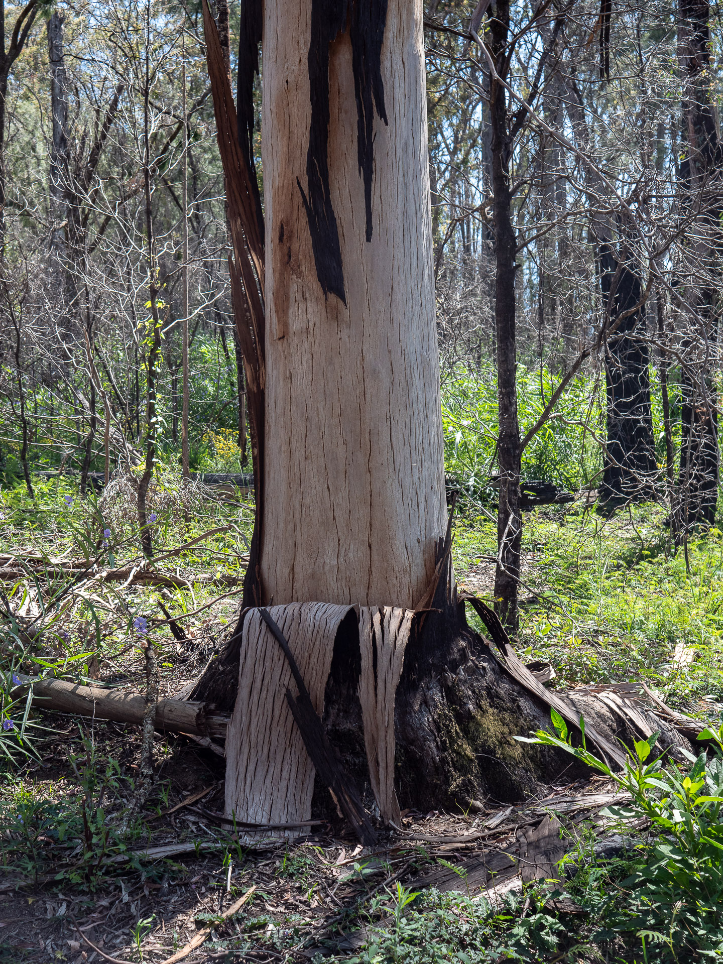
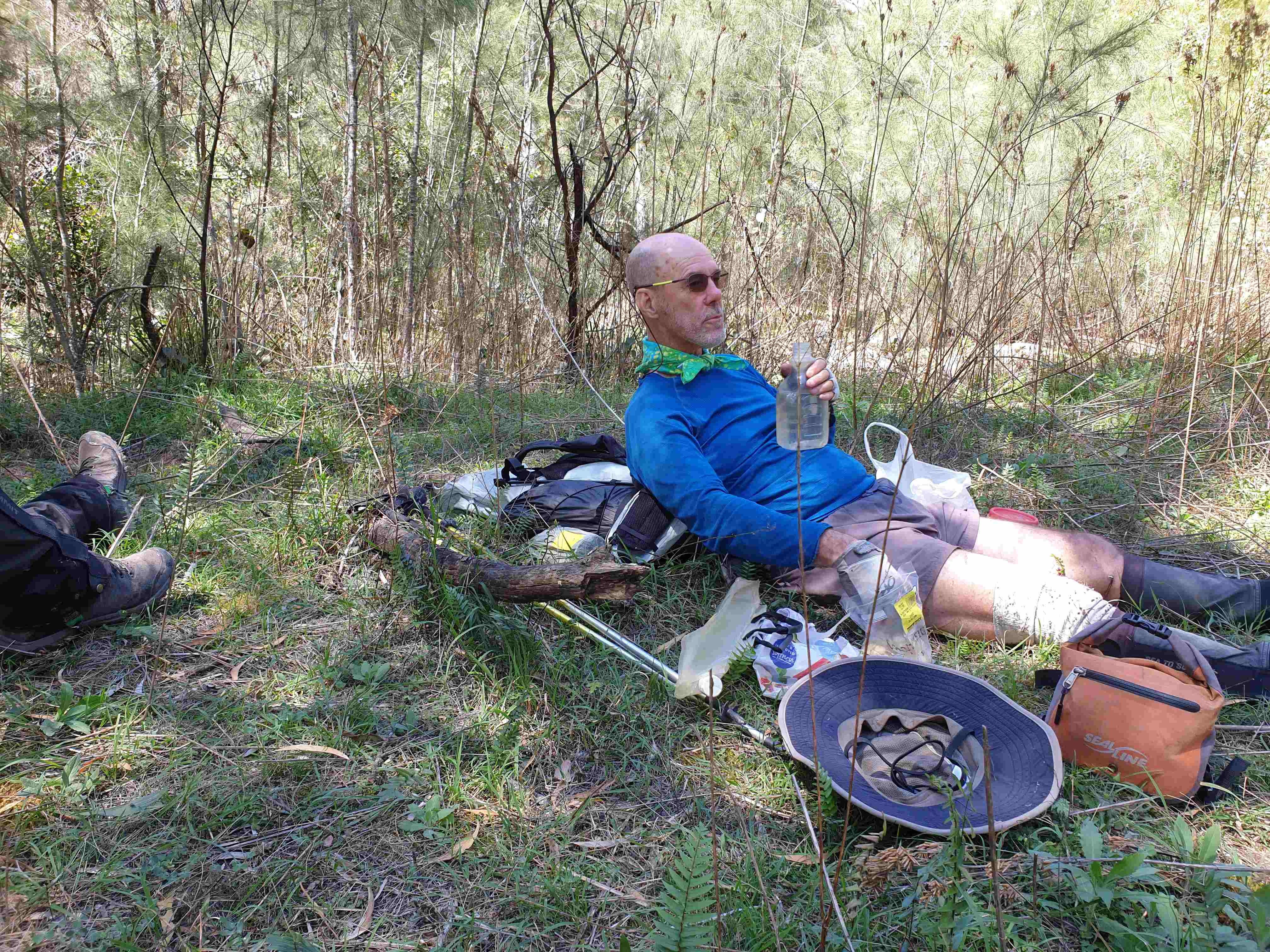
Any idea of enjoying a high camp amongst the thick fire regrowth was out of the question – and we needed to find water before dark. But where? Optimistically there were several farm dams marked on the map that could meet our needs. Two dams were empty, the next had muddy water while the forth was good enough with treatment, but others rejected it. So we walked on, into the dark, working slowing down to the Mira Creek headwaters. Our torches revealed creek banks carpeted with dead stinging tree leaves and no water. After a dedicated search, Ian found water upstream, and we had our camp of sorts. It was not a great start …
Day 3, September 26 – to Mernot Creek – (300m climb, 4km on road, 800 descent, 6km off track)
A steep climb of 300 metres to Sunny Ridge Trail was a shock to the system, after a surprisingly comfortable camp on Mira Creek, but it did make walking slowly down fire roads a welcome change. The nice morning saunter along a fire road ended with a descent off track to Curricabark River, and again there was disappointment as the valley was weedy. After lunch, and with expectations now lowered, we headed up Mernot Creek that gradually improved till a reasonable camp among scattered blackberry bushes was found by mid-afternoon near the ascent point to Monkeycott Bluff.
Day 4, September 27 – to Monkeycott Bluff –
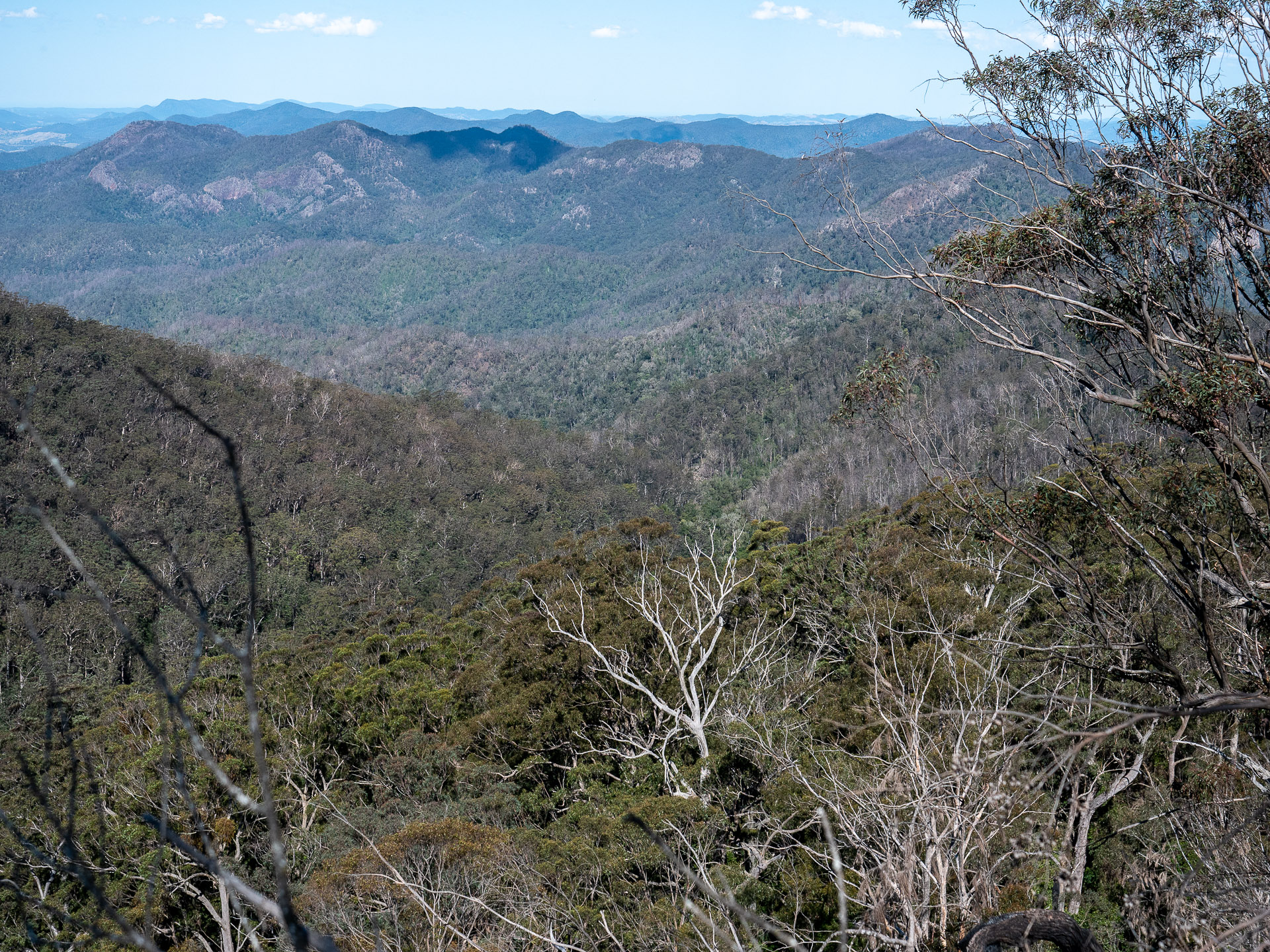
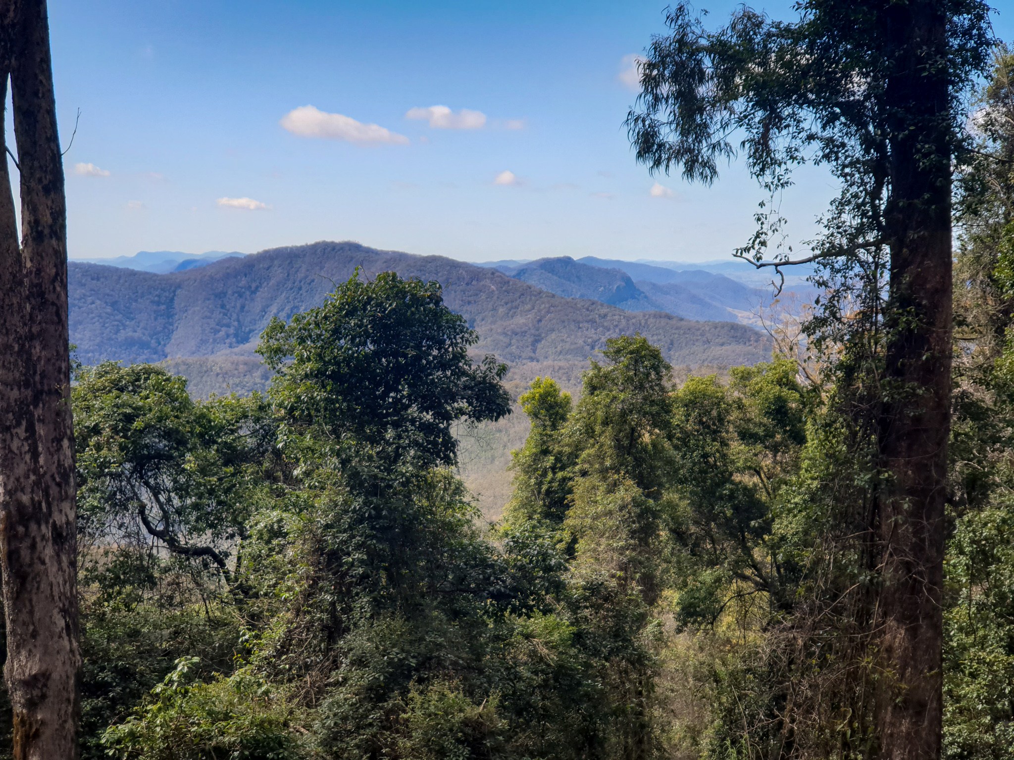
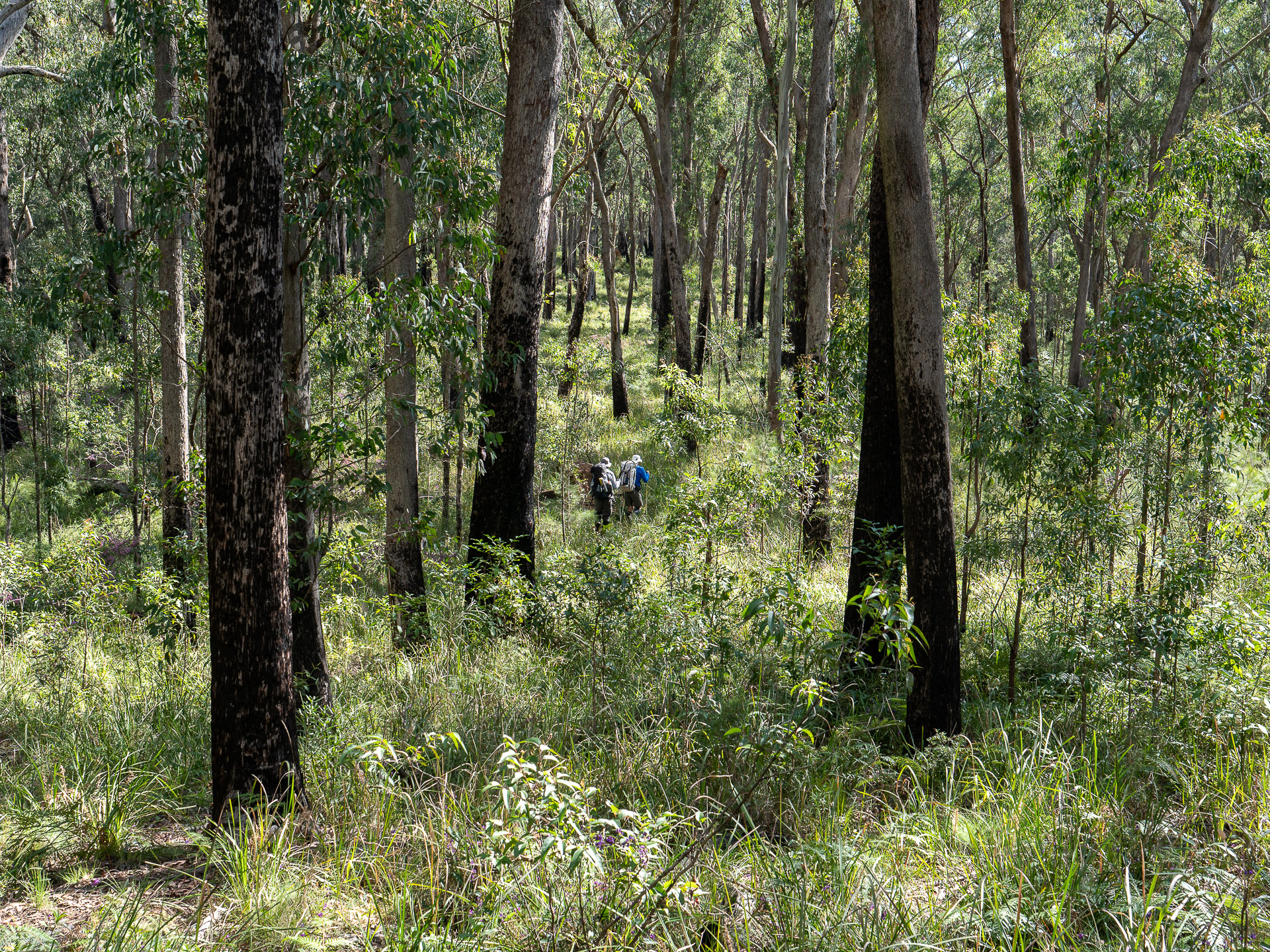
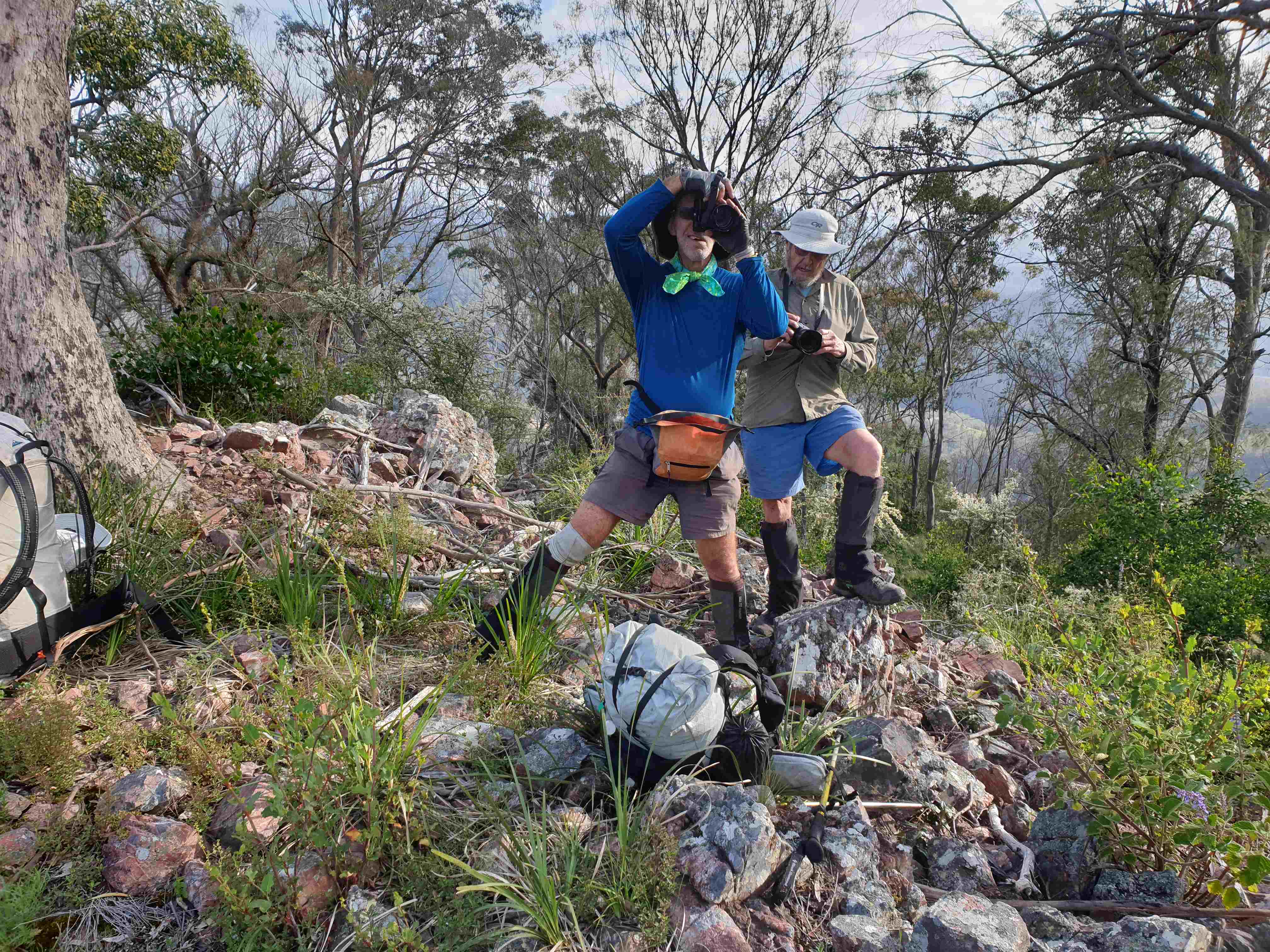
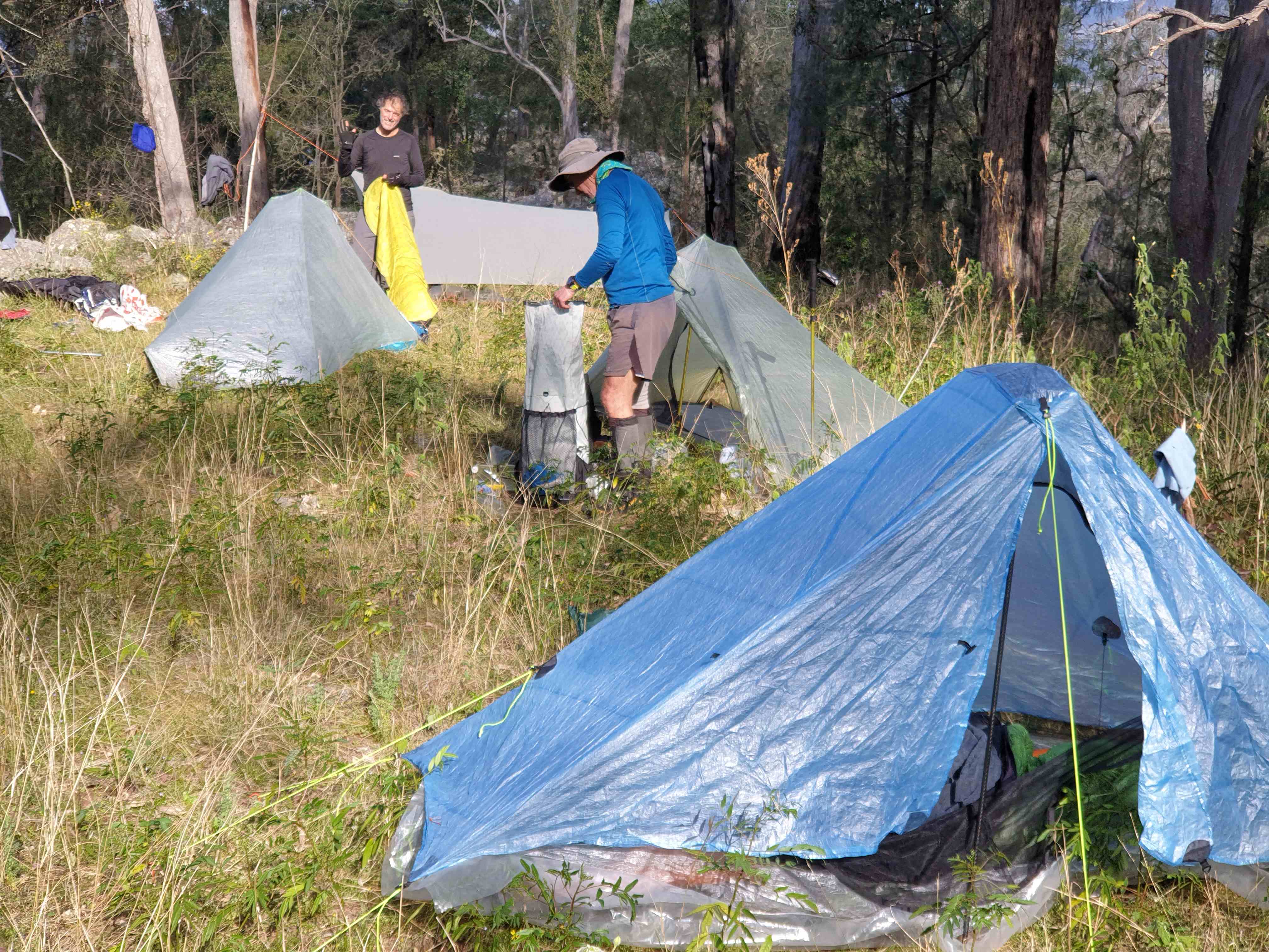
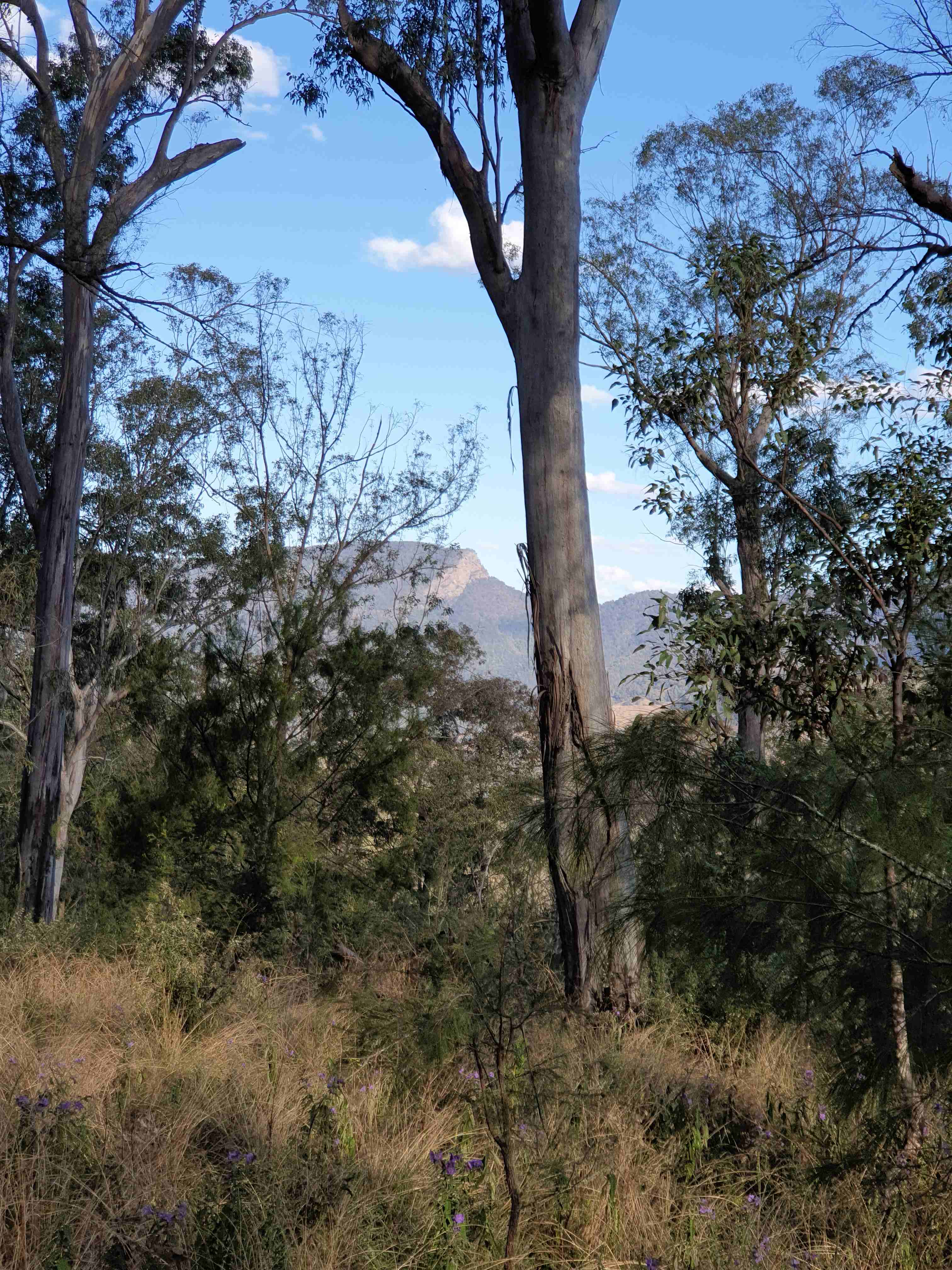
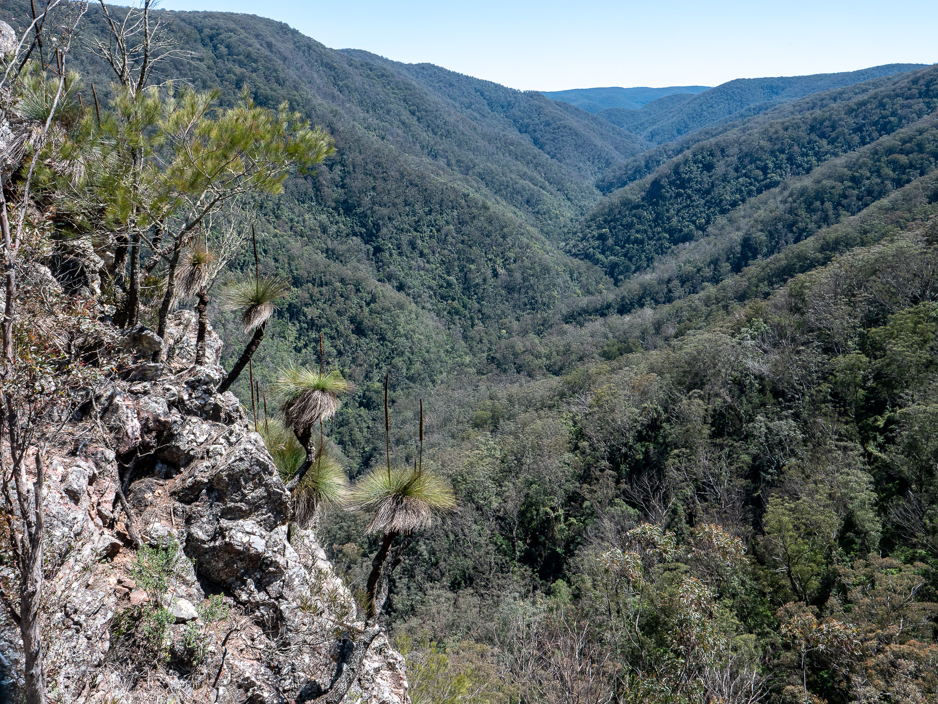
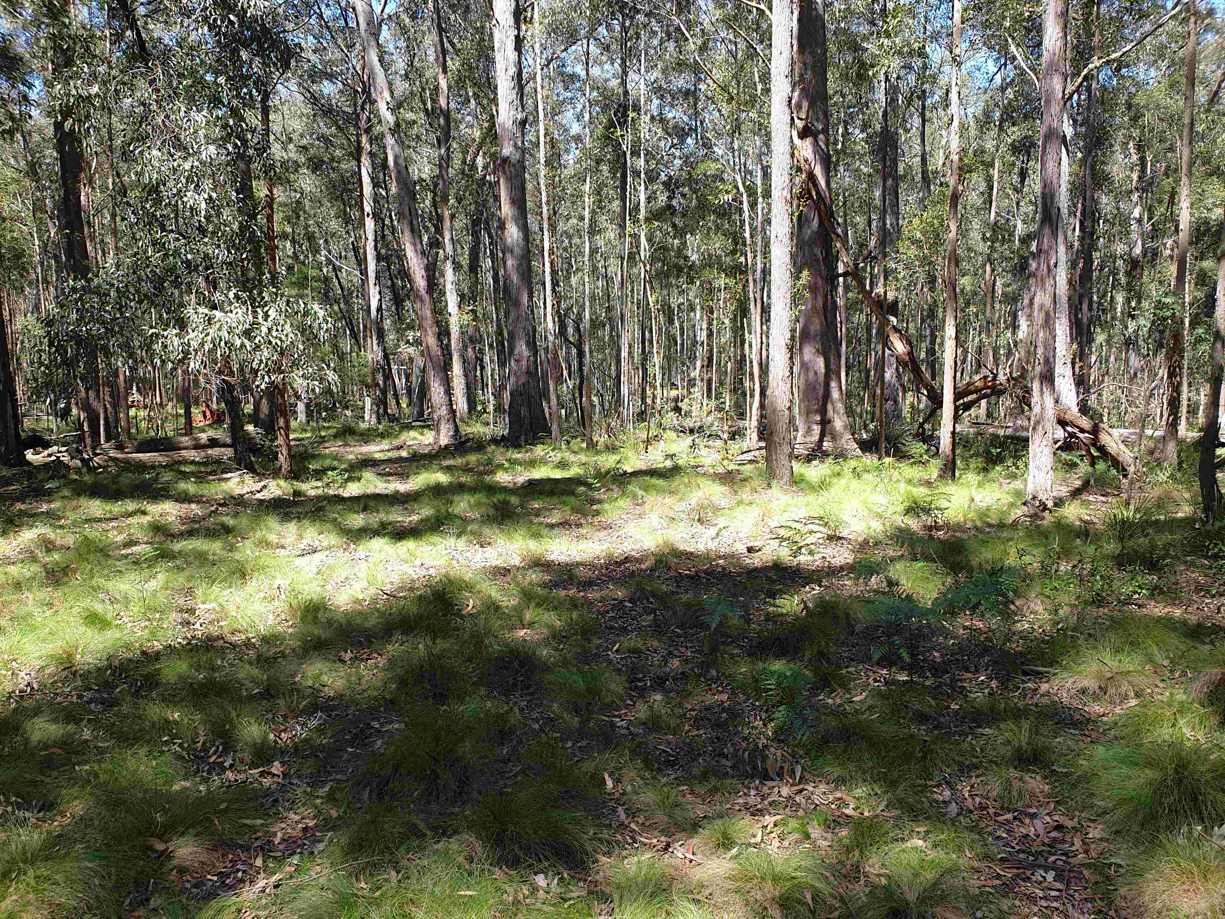
The first highlight of the trip was the 700m climb from Mernot Creek. First on a 4km long ascent spur and then a gentle 3.5km ridge traverse to camp near Monkeycott Bluff at 960m. After pushing through “scungy” vegetation on the previous two days, it was a delight to be in a pristine open grassy woodland replete with spring wildflowers. It was great walking, and Monkeycott Bluff offered spectacular views to the north-west. The hard work carrying water up was worth the effort, as we arrived early enough to fully enjoy a comfortable camp with great views.
Day 5, September 28 – to Barnard River then London Bridge Creek (750m descend and 7km; or 1350m down and up 14km to high camp)
The 3km descent spur dropped 750m to river was enjoyable but the views of the broad valley landscape indicated it too was full of weeds. The spur also provided views of north-facing rainforest gullies where mature trees had died in the recent bad drought. The condition of the rainforest was in striking contrast to the healthy woodlands of the ridge tops that received sufficient rain.
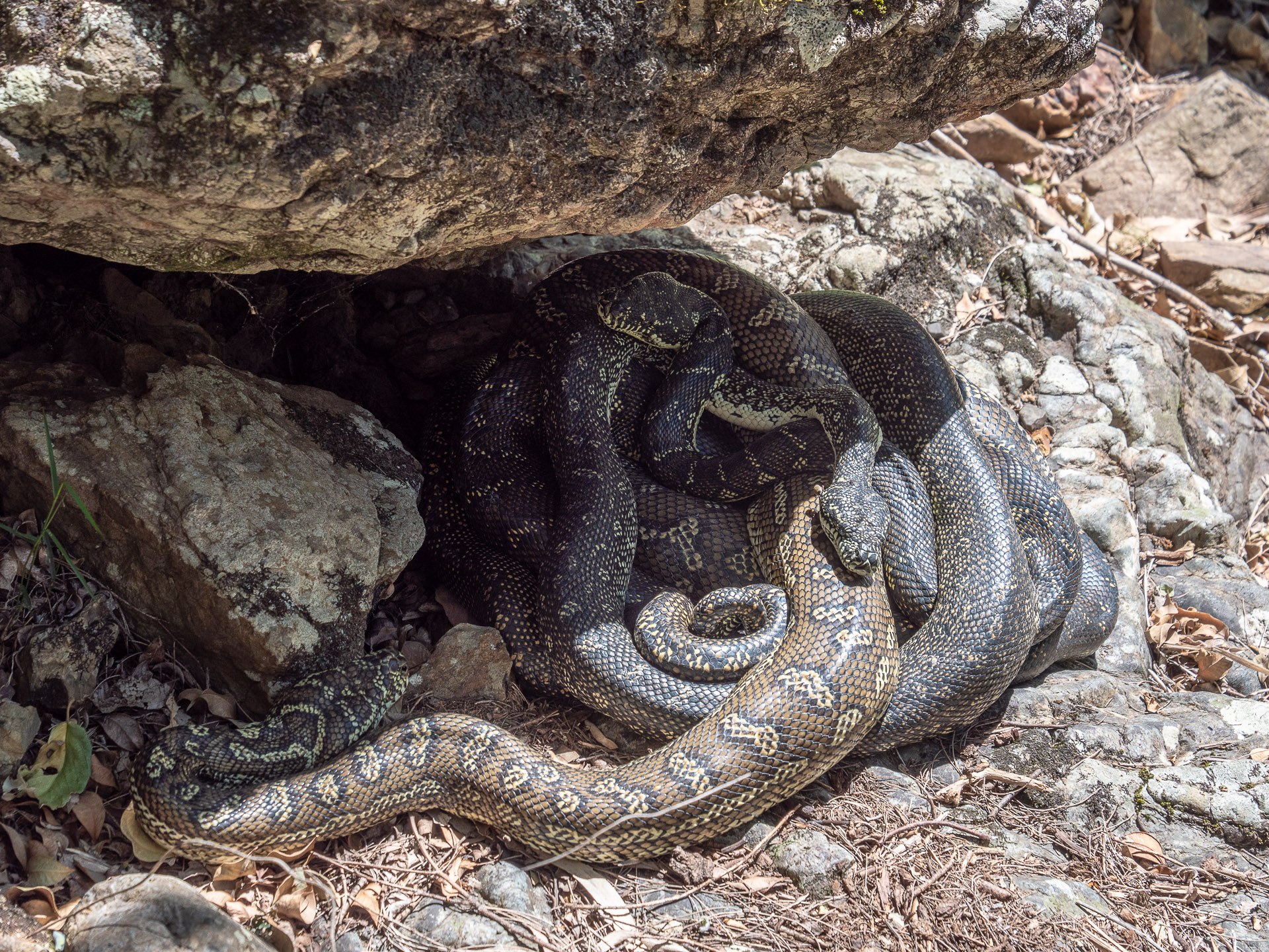
We followed the Barnard River west upstream, firstly along Monkeycott road till it veered uphill and then along the river past a colony of Brush-tailed Rock Wallabies hanging on in what was in 2020 a parched landscape. The 6km along the river to the London Bridge Creek junction had nothing to commend itself to walkers, except opportunities for a swim and wash.
If ever attempting this trip again, it might be better to ascend more directly to Cobbs High Point, and skip river. As it turned out, the party carried water for another high camp, to avoid camping amongst weeds of a recovering pastoral valley landscape after a bad drought.
We worked our way slowly up and around gullies of London Bridge Creek to another promising spur lead us towards the Black Springs Range. We stopped about a third of the way up on a flat point of the spur with views through the trees back to Monkeycott Bluff. As soon as you leave the valley floor behind, the landscape again reverts to a grassy forest full of wildflowers and we had time to explore after setting up camp.
Day 6, September 29 – Tuggolo Creek (350m up and 500m down, 7.5km)
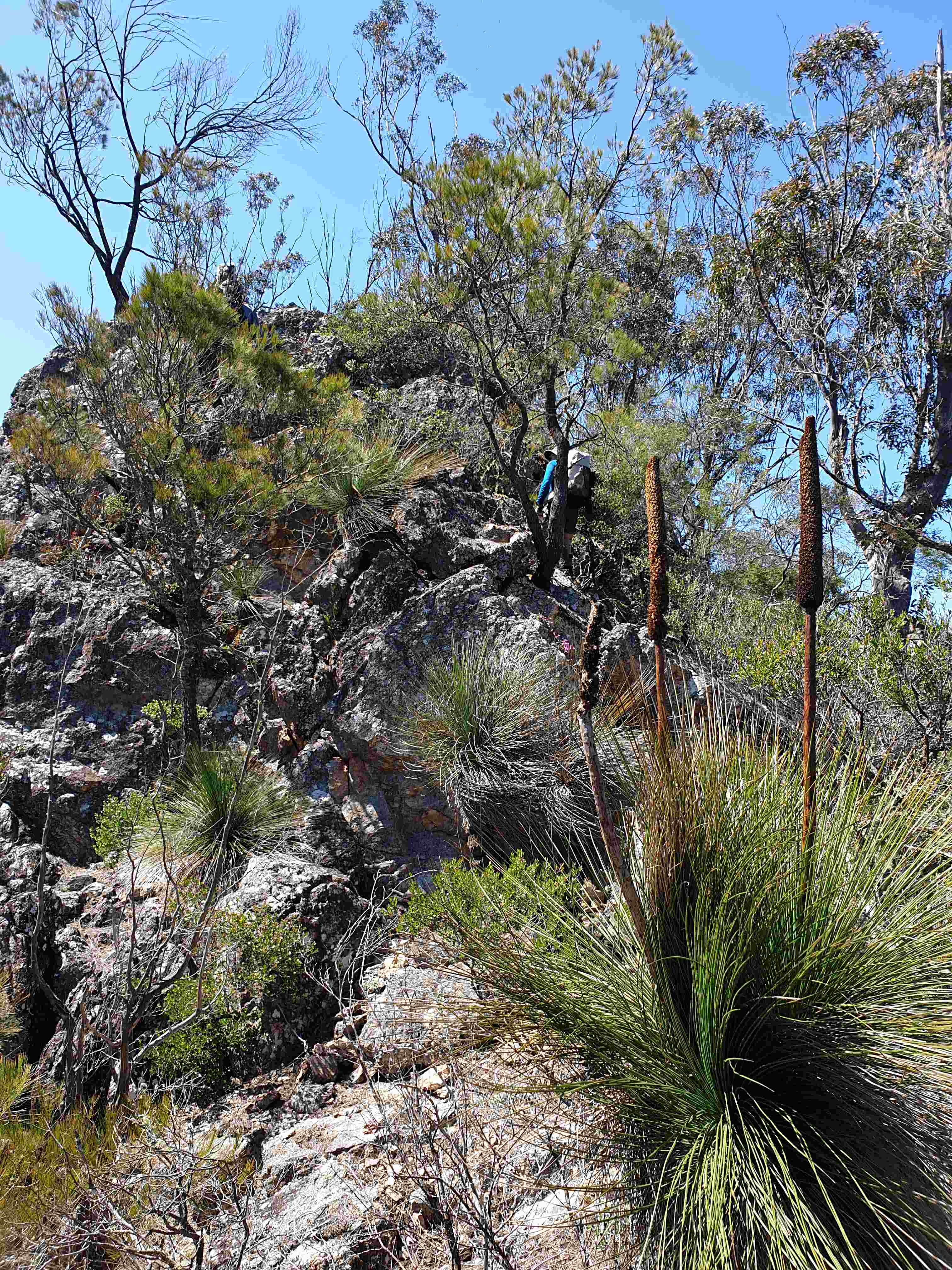
The next morning Camp we climbed climb 350m in 1.5km to Black Springs Ridge but did not visit the important Aboriginal site but descended to Black Springs on Tuggolo Creek for a long lunch. We needed to chew over the final leg of the walk, as there were a few route options. Resting amongst the river oaks was a nice way to spend lunchtime. The option of walking downstream, then a short road bash through farmland and working our way along the lower reaches of Myall Creek was quickly discounted. No more weedy valley walking was the consensus.
So we opted for a bit of slow upstream creek walking and poked into Bullock Range Creek for a camp amongst tall gums, again being careful to avoid the stinging tress and the dead leaves on the ground. It was challenging to vary the trip plan but it definitely improved the last leg.
Day 7, September 30 – Walk to Myall Creek (760m up and 570m down, 12.5km)
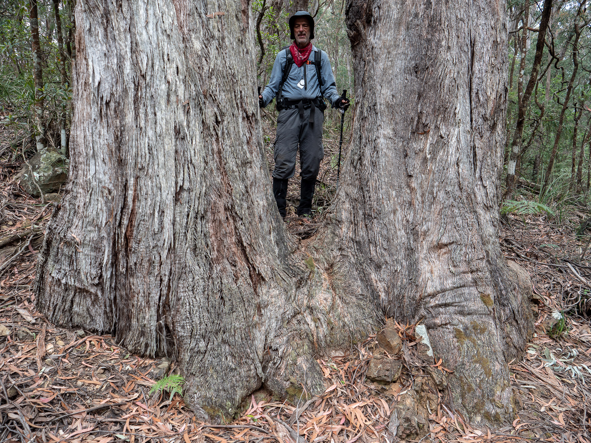
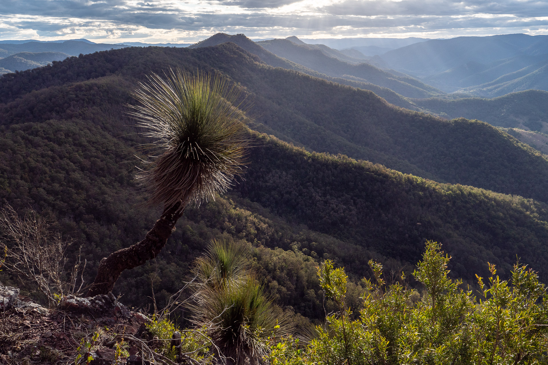
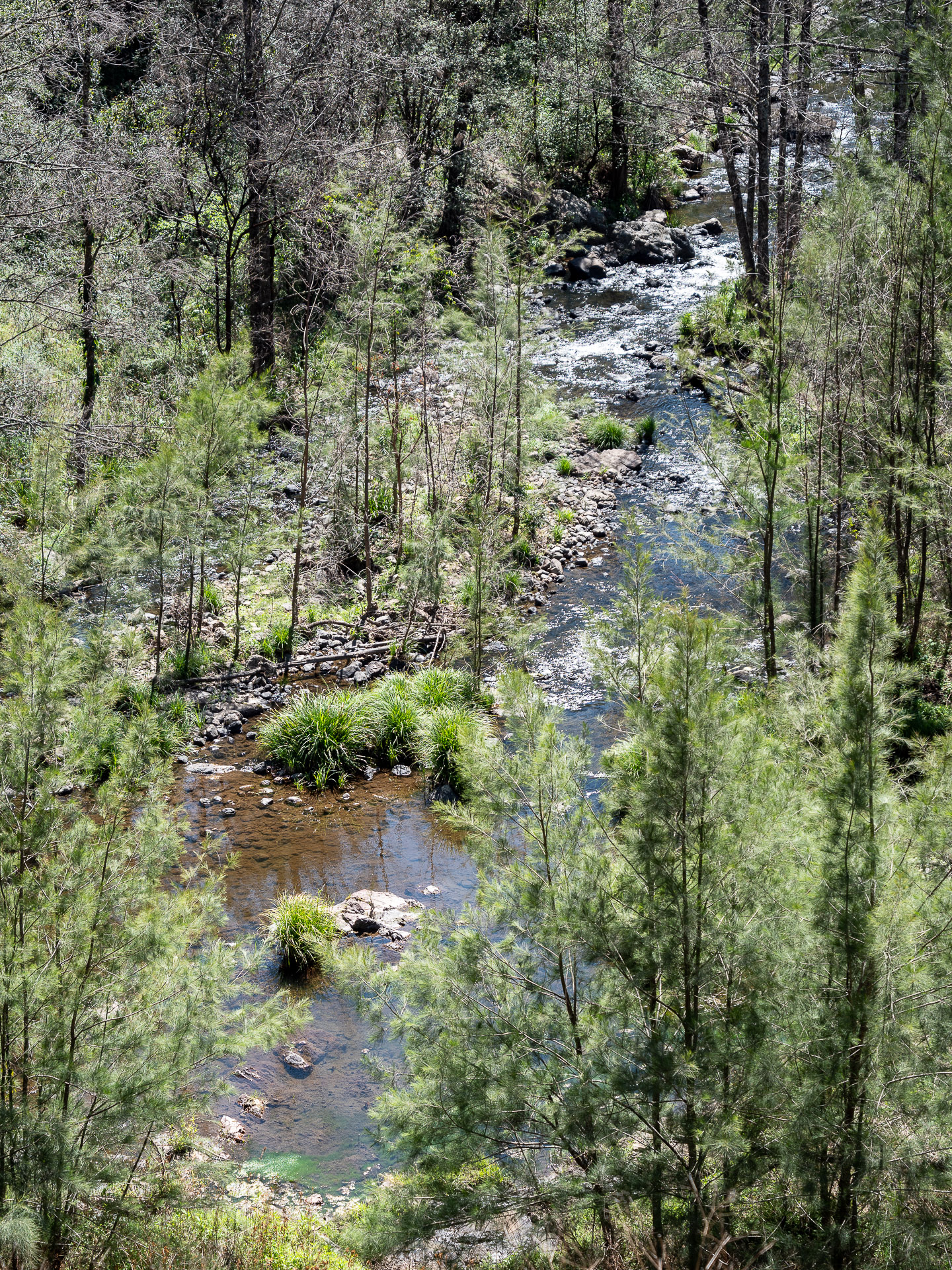
This was our biggest day’s walking, ascending into Nowendoc National Park’s and its tall wet forests and then more easy walking along a fire road. These eucalypt forests were a taste of the landscapes of the Great Escarpment that were enjoyed on our last few days. The party entered Tuggolo State Forest for about four kilometres on the Giro fire road. Its intact old growth there should be added to the national park, otherwise it will be decimated at some time, although currently protected by informal reserves.
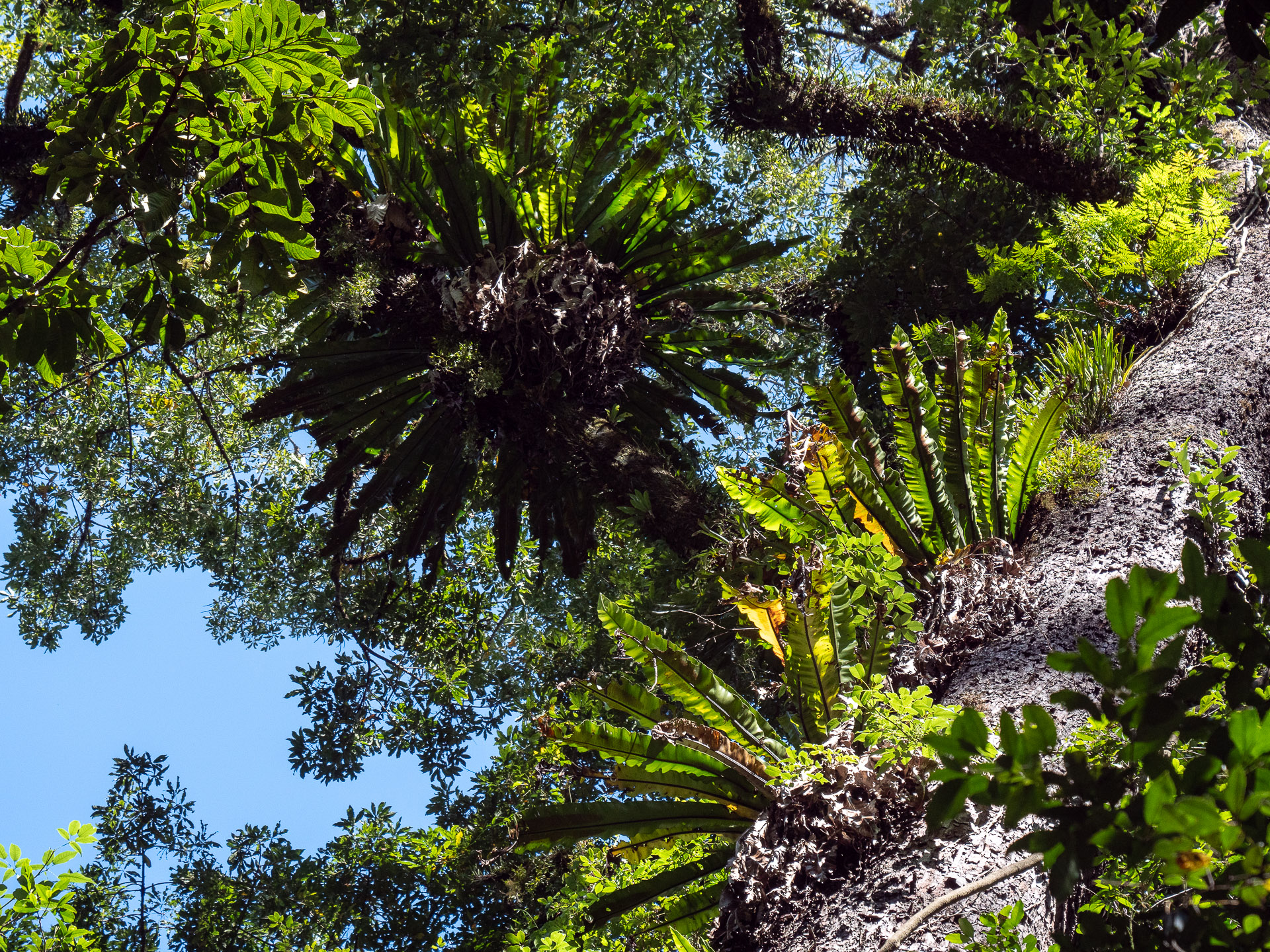
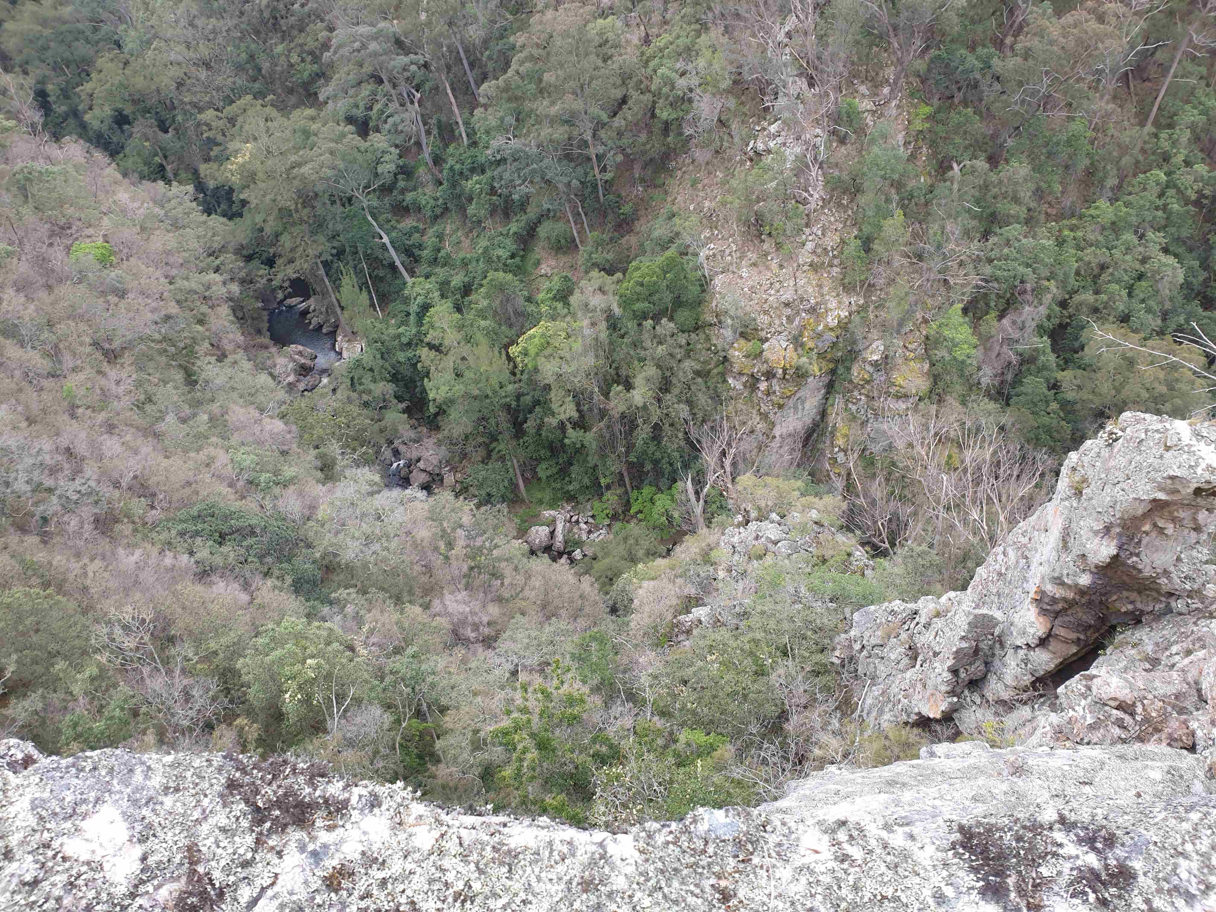
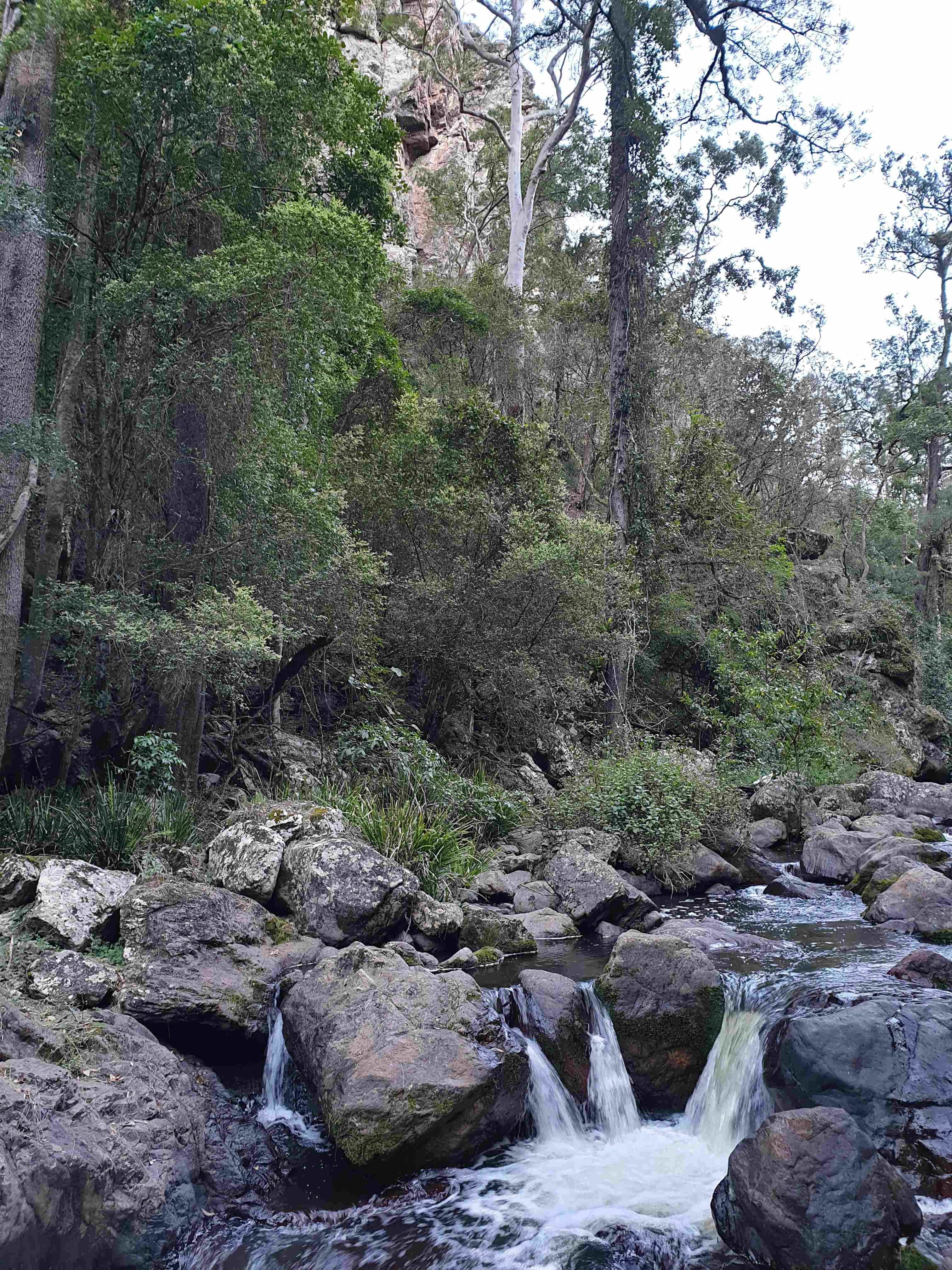
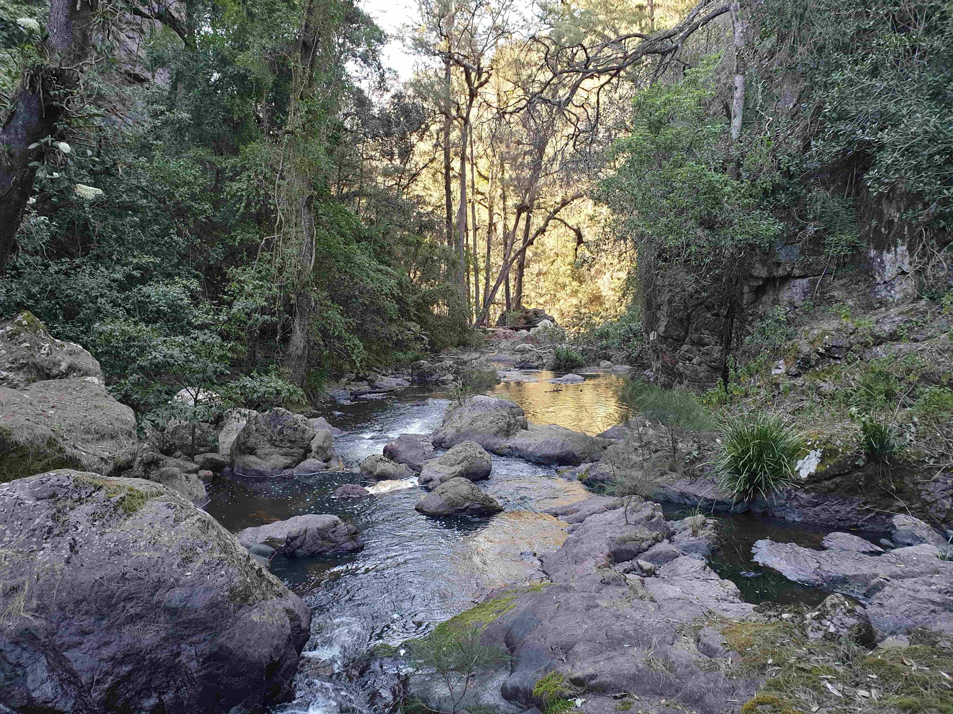
The last part of the day was a really steep descent to spectacular Myall Creek. Two dramatic rocky bluffs yielded vertical views of the creek and confirmed that an off-spur diversion was not an option. Eventually arrival heralded a lush rainforest world of the creek. This Great Escarpment environment was so unlike the rain shadow valleys and grassy woodland ridges of the coastal foothills previously experienced.
Days 8 and 9, October 1 and 2 – Myall Creek (5km down Myall Creek, 700m up and 12km along ridge and fire road walk to car and drive to Sydney)
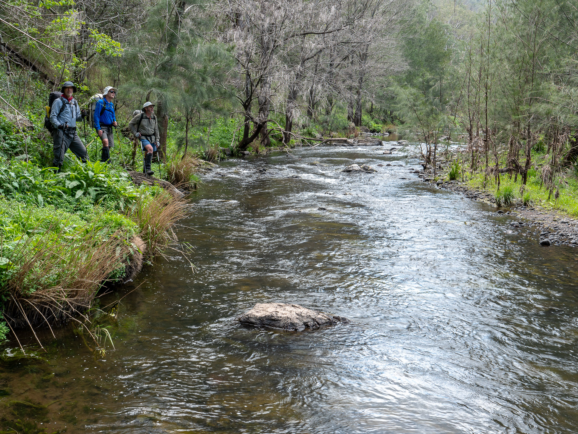
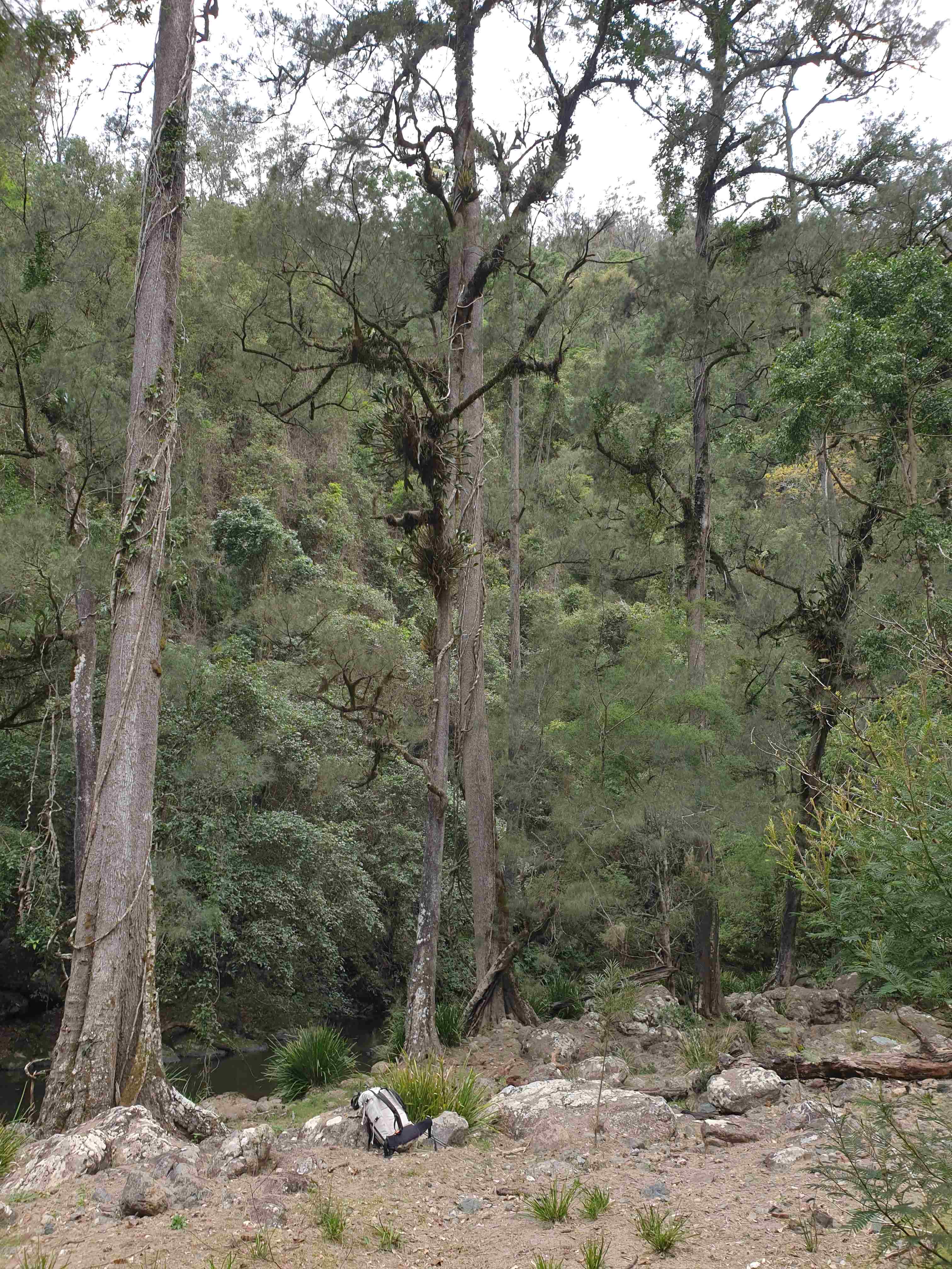
We had a nice day exploring Myall Creek and worked out that we could exit about 5km downstream. So the day was spent taking photographs of wonderful Myall Creek.
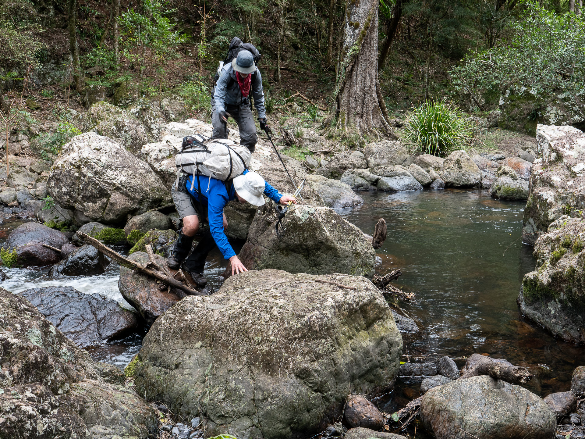
As usual with exits from deep gorges, it takes a while to find a way out. A rocky constriction 5km downstream made reaching the ascent spur a bit tricky but we got around it without getting wet, then a steep climb up 600m in just 1.5km gave some spectacular views of the creek gorge before the to top of ridge which was gained by morning tea. We followed a 4WD access road for 3km and arrived at the car for lunchtime. We felt pretty good about the trip on the way back, with its ups and downs, weeds and wonders.
The drive via Woko Campground took 5.5 hours to Sydney/Katoomba that day arriving in time for dinner around 7.30pm. The rest on the day before enabled the exit and long drive to be done safely, in an alert state. As the old saying goes; the most dangerous part of any trip is the drive home.
- Log in to post comments