Car camping options:
Woko camp ground on the Manning River is nearest Gloucester and the commencement point for the walk described in the trip report or perhaps a lazy car camp by the Manning River.
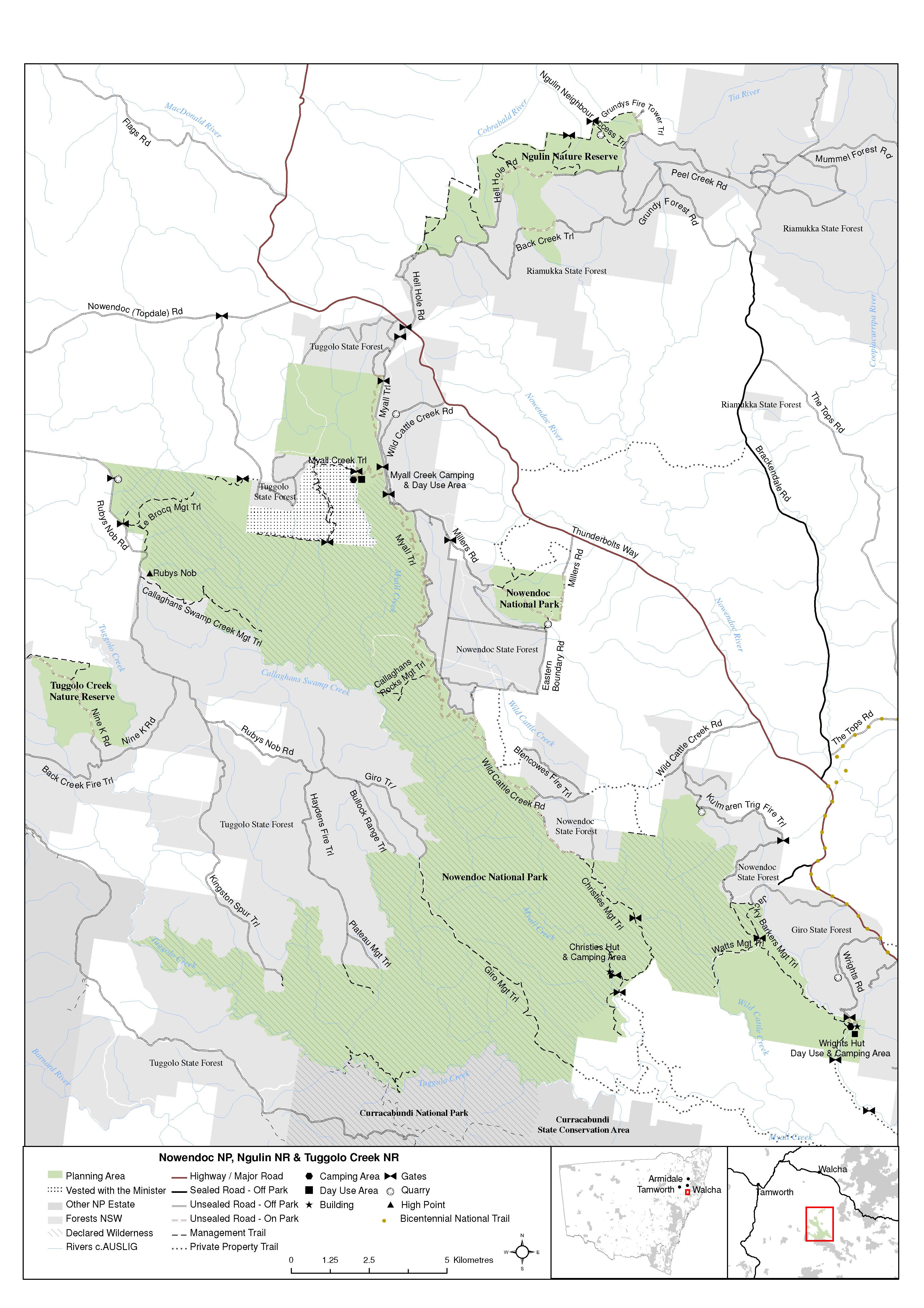
Myall Creek Camping Ground is nearest to Newendoc, take a left off the Thunderbolts Way at Wild Cattle Creek, and also offers rugged wilderness walking entirely within Nowendoc National Park. From this camp ground you can walk to Wrights Hut or Christies Hut Mgt Road entry point via ridges and Myall Creek. There are several options for start and finishing if you examine the Plan of Management maps at the bottom of this page.
Curracabundi Trip Report
Emergency beacon advice and Curracabundi trip plan logicists - example for a party of 4
A rough south-north navigation outline:
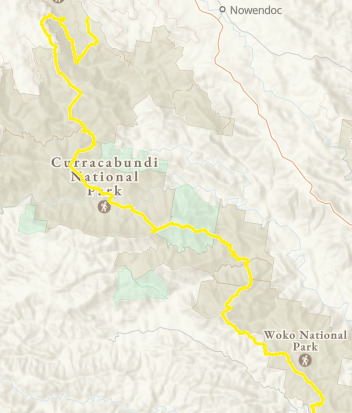
A hard, eight day, 80km walk, mostly off track over rugged terrain from Woko camp ground to Nowendoc State Forest. The route of travel ascends from the Manning River then north along ridges, down into deep valleys and finally up over the Great Escarpment on the last day. Much easier walks are described below, this one is for experienced walkers.
The first section might be better avoided until it recovers from fire damage. The route traverses the crest of Woko National Park to Curricabark River. Allow time for the bush to recover after being intensely burnt in the 2019-20 fires, say after 2025.
The Karamea Homestead and Mernot Creek Road from Thunderbolts Way provides an alternate start point option that avoid the first section of the wilderness damaged by fire. The ridge up from Mernot Creek Road to Monkeycott Bluff is excellent walking through undamaged old growth grassy woodland.
The descent from the Bluff to the Barnard River valley is best done by most direct route to around Cobbs High Point and then Tuggolo Creek in Nowendoc National Park.
Take time on the final stage to explore the in upper and middle sections of Myall Creek, a spectacular rainforest gorge but slow going.
Short description of the area's heritage values
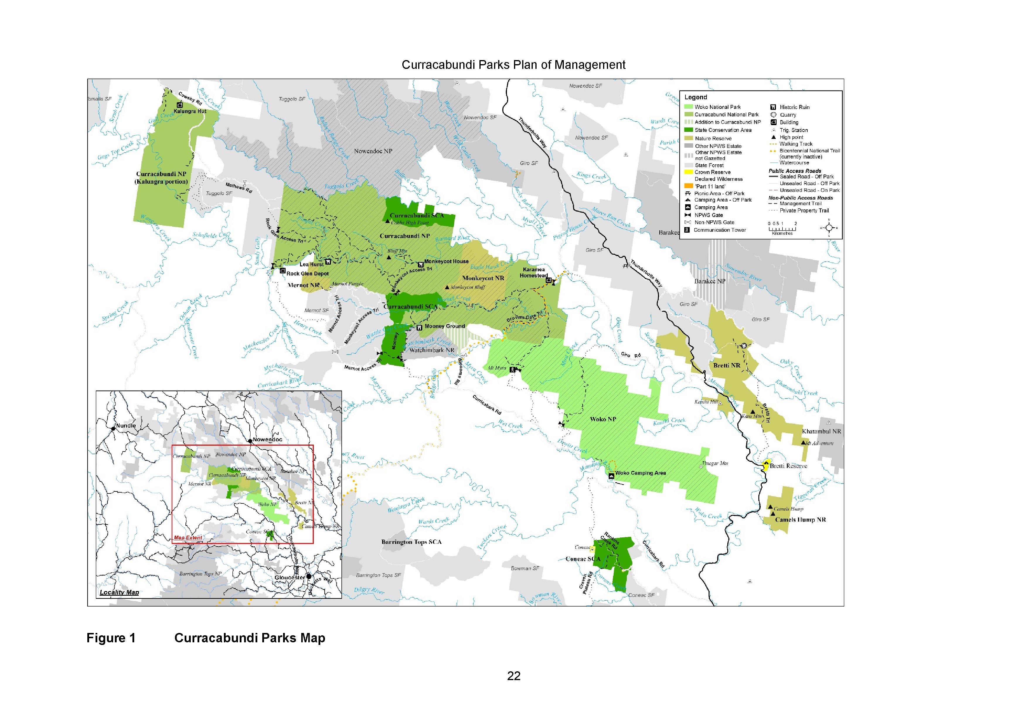
Gazetted in 2011, Curracabundi is the newest NSW wilderness and located north-west of Gloucester and currently 34,000ha of the 48,000ha area are protected. It is a rugged wilderness. If you are less experienced, then consider visiting the other areas on this site.
The wilderness straddles the upper Barnard River and its main tributaries that drain the Great Escarpment. Walker will experience mountain ridges, rivers, rainforest, and old growth forests and woodlands, as well as several large, weedy valleys recovering from past use.
Elevation ranges from the heights of Larndel (1342m), Monkeycott Bluff (966m) and Mount Myra (1057m) to the valley floors of the Curricabark and Barnard rivers (only 200m). The Peel-Manning Fault System is expressed in the area’s spectacular rocky outcrops, high ridgelines and deep valleys. In most of the underlying rocks are Silurian and Lower Devonian sedimentary or metasedimentary rocks known as the Myra Beds that consist of chert, jasper and argillite. In the Watchimbark Nature Reserve, unusual Cambrian serpentinite rock produce a toxic soil that supports an unusual spinifex and grasstree heath; the largest spinifex occurrence east of the Great Divide.
The dry and subtropical rainforest gullies have stinging trees so take care when in these environments, even the dead leaves give you a powerful sting that can last for days. River oaks line the valley streams, and grassy woodlands and natural grasslands clothe the lower valley slopes. The rugged wilderness is habitat for the koalas and parma wallabies, spotted-tail quolls are locally abundant above the escarpment and on north-facing rocky slopes above the Barnard River have a threatened population of brush-tailed rock-wallabies.
When to go: – spring or autumn. Summer would be too hot. Walking can enjoyed in winter, provided you dress appropriately, but it obviously will be too cold to enjoy the streams.