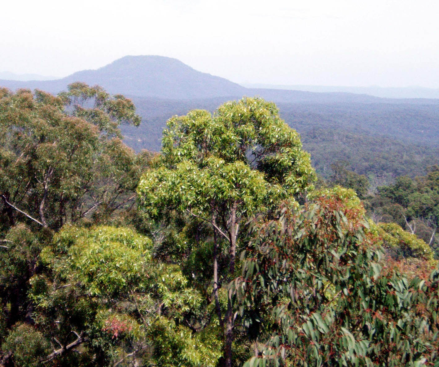
Yengo is a great bush walking destination, being a classic, heavily dissected sandstone plateau wilderness of interlocking spurs that rises above the Hunter Valley toward Mount Yengo (668m), a prominent basalt peak. It is not as rugged as other parts of the Greater Blue Mountains World Heritage Area, and finding passes through low clifflines above streams is usually straight forward.
Yengo, the closest wilderness to Sydney and Newcastle, has the highest plant diversity of all the Blue Mountains World Heritage listed wilderness areas due to its strong north-south rainfall gradient and landscape complexity. Splendid spring wildflower displays in its mixed eucalypt and angophora forests are due a diverse under storey of Banksias, Grevilleas, Hakeas, Boronias, Lambertias, Persoonias, Grass Trees and Native Holly. Hanging swamps dominated by Melaleucas are found in the heads of several creeks and along the banks of major streams grow Sydney Blue Gums. Rainforest pockets of Coachwood, Water Gum and occasionally Stinging Tree are found in the deepest gullies, and on Mount Yengo there are isolated stands of Kurrajong. Fauna includes five Threatened species: the Turquoise Parrot, New Holland Mouse, Broad-headed Snake, Brush-tailed Rock Wallaby and the Koala.
When is it best to go?
During drought (El Niño), its best to plan walks along its main streams, with the Macdonald River, a recognised wild stream, being the principal drainage system in this wilderness. Others streams are frequently dry during a typical rain year. The region around Mt Isobell to the north of the Hunter Range is much drier, making it a destination for wet (La Niña) periods. The the Parr State Conservation Area, well to the south of the Macdonald River, is wetter and more scrubby.
Navigation
Off track travel and navigation are best when you to keep to the ridges. Circuit walks of over a week can be planned in the area south of the Hunter Range.
As with many wilderness areas, there is a maze of maintained and disused 4WD roads and fire trails. These access tracks, along with the Macdonald River, Howes Creek and old clearings associated with Big Yango Station offer walkers opportunities for faster walking routes if delayed, find the bushland hard going or you want a quicker exit at the end of your trip.
Big Yango Station – an unfortunate 5,000 hectare central hole in this wilderness, is provided with 4WD vehicle access around Mt Yengo that is regulated by permit. Walkers can chose to dodge around Big Yango Station (and the noise of 4WD vehicles) by following the surrounding north-south ridges perpendicular to the Howes Trail and the Yango Track.
Entry points for walkers:
Putty Road and then east –
- via Northern Link trail to Old Settlers Road (also known as Old Convict Road) and taking ridges radiating north and south off the Hunter Range. Use this route for Mt Isobell and for longer circuit walks Mt Yengo;
- along Howes Trail to access Mt Wareng (Little Yengo), it is also possible to access Howes Valley Creek from this trail, its sandy bed is quick walking in dry weather;
- by Wallaby Swamp Trail a 4WD management road that offers rapid walking access to the central part of the Macdonald River from the west;
- by the disused and shorter Howes Range Trail that leads half way to the Macdonald River that can then be reached at various points across a complex of confusing ridges;
- following the Womerah Range mountain bike trail and then following ridges north to Melon Creek.
The Putty Road also provides access to the northern Mt Isobel section of the wilderness. Approach the Bulga Range from where the Northern Link Track comes off the Putty Road. The north-south trending Old Bulga Road follows the powerline along this range and, once Bulga Creek is crossed to the east, there are various options to enter this rugged, often dry area. It may be necessary to walk the Old Bulga Road, as it is only a service road. This northern precinct can also be approached from the Hunter Range (see dot point one above).
From the Wollombi Road south of Laguna you will find Yango Track is the best option for approaching the Yengo wilderness from the Hunter Valley by vehicle. It is nominally a 4WD road, but with care and good sense can be tackled by conventional car if the weather and road conditions are good.
In the south east the Wollombi Road road is also known as the Mogo Creek Road and provides access to the Mogo Creek region of the wilderness.
The Boree and then Bala Range Trails off the Wollombi Road head west toward the lower sections of the Macdonald River or offer an approach to Yengo Creek in the north and the Calore Range. Its more direct, however, to tackle Yengo Creek from the north by the Calore Range from Big Yango via the Yango Track.
Car camping options
There are no formal NPWS car camping areas off the Putty Road. Booked camping and a former farm house are available “Big Yango Station” accessed by the Howes Valley Trail and Big Yango Track by 4WD vehicle.
Those without a 4WD vehicle, have two free car camping opportunities on the east side of the park at Finchley on the Yengo Creek Road (also called the Yango Track) and Mogo on the Wollombi Road (also called the Mogo Creek Road at this point). Walk in camp sites, pit toilets and fireplaces are provided.
On the southern edge of the park is Heartbreak Hill campground just in the Parr State Conservation Area. Walk or ride in on the Womera Range off the Putty Road.
Mill Creek campground is to the southeast in the Dharug National Park on the Hawkesbury River. Sites must be booked with the NPWS. Ten Mile Hollow on the Simpsons Track, just off the convict built Great North Road is also in Dharug National Park but accessible by walking or cycling a short distance on the multi-day Old Great North Road hike.
Seven day walk rough guide - Mt Yengo circuit via Howes Mountain
Start at Northern Link trail junction with the Putty Road, where cars can safely be left without being seen from the road. Then Howes Mountain, along Hunter Range, by a ridge to Back Creek, then another ridge south to cross the Hunter Range to Big Yango Station (or south on a ridge to the east of the Station), then to Yengo Creek and thence Calore Range or if travelling well, the Bulgalaben Ridge. From there follow the Macdonald River upstream, ascend a suitable spur to Mt Yengo and north along a ridge to the Hunter Range and return to the start by various creek and ridge options.
References
Discovering Yengo and Dharug National Park on foot (2001) by Anthony Dunk gives a starting point on walks available, the NPWS website offers further ideas http://www.nationalparks.nsw.gov.au/visit-a-park/parks/yengo-national-park – contact the NPWS on (02) 4320 4200 for vehicle access information.